OS1/20/127/5


| List of names as written | Various modes of spelling | Authorities for spelling | Situation | Description remarks |
|---|---|---|---|---|
| CAMBRET HILL | Cambrit Hill Cambrit Hill Cambrit Hill Cambrit Hill Cambret Hill Cambret Hill Cambret Hill |
H. McClymont A. McClymont John Heron A. McQuhir Ainslies Map 1820 John McConchie Charles Rogan See also Name List Plan 42B |
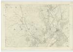
043 | [Situation] 1 1/4 miles north of Claughreid. A tolerable sized hill on the farm of Cambret (hence the name) its Surface consists of rocky heathy pasture. On its summit is a Trigl. [Trigonometrical] Station called by the Trigl. Party "Cameron Hill". This hill is a prominent part of a Small irregular range. |
| CAMBRET MOOR | Cambrit Moor Cambrit Moor Cambrit Moor Cambrit Moor Cambret Moor Cambret Moor Cambret Moor Cambret Moor Cambrot-muir |
Alexander Carson G.Tait John Heron A. McQuhir Mr Hamlton Stat. Acct [Statistical Account] (1845) John McConchie Charles Rogan Simpson's Description of Galloway Page 47 |
043 | [Situation] About1 1/4 Miles N.by E [North by East] of Clauchreid. A Considerable tract of Moorland on the farm of Cambret (hence the name). It was on this Moor or near it where a battle had been fought between the Scotch & English in which the Bishop of Whithorn assumed the Command of the Scottish Army, and was slain and interred in the Cairn called the "Holy Cairn" of which see description in an adjoining name list. |
Continued entries/extra info
[Page] 5 Parish of KirkmabreckTranscribers who have contributed to this page.
IanMcC
Location information for this page.
Linked mapsheets.