OS1/35/46/5


| List of names as written | Various modes of spelling | Authorities for spelling | Situation | Description remarks |
|---|---|---|---|---|
| DRUMDOW BURN | Drumdow Burn Drumdow Burn Drumdow Burn Drumdow Drumdow Drumdow Burn |
John McKie James McKie David Lauderdale Ainslies map 1782 Map of property 1790 George McHaffie Esqr. |
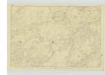
018 | [Situation] East of Anabaglish Moss and S by E [South by East] of Anabaglish Farm House. A Small Stream taking its rise in the mosses near the Junction of the farms of Drumdow, Anabaglish and Challochglass running in a northerly direction & in some parts forming the boundary between the parishes of old Luce and Mochrum and at length runs into the Tarf Water. |
| ANABAGLISH | Anabaglish Anabaglish Anabaglish Annabaglish Animaglish Annabagliesh |
David Lauderdale John McKie Ainslies map 1782 Royl. Engrs. [Royal Engineers] map 1819 map of property George McHaffie Esqr. |
018 | [Situation] 3/8 mile N by W [North by West] of the Junction of the Parishes of Old Luce Kirkcowan & Mochrum. A Small thatched farm house in bad repair with a farm of 1400 acres the greater part of which is moorland occupied by David Lauderdale The property of the Earl of Stair |
Continued entries/extra info
[Page] 5Parish of Old Luce
Form 136 Page
27 ; 47 -- Drumdow Burn
31 -- Anabaglish
" Uaine boglach - The green bog or morass
note A large tract of bog on
this this farm
Transcribers who have contributed to this page.
Chr1smac -Moderator, JCB
Location information for this page.
Linked mapsheets.