OS1/35/37/29


| List of names as written | Various modes of spelling | Authorities for spelling | Situation | Description remarks |
|---|---|---|---|---|
| MAINS OF KILDROCHET | Mains of Kildrochat Mains of Kildrochat Maind of Kildrochat Kildrochat Kildrochet Kildrochet |
Abraham McWilliam Robert Pringle Thomas Hunter Mr. Cumming Ainslie's Map 1782 Rl. Engrs [Royal Engineers] Map 1819 |
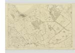
016 | [Situation] About 3/4 mile E by S [East by South] from the village of Lochans A neat and handsome Cottage 2 Stories high with suitable out offices including Stabling etc. with Garden and pleasure ground attached situate near the north side of the road from Stranraer to Stoney Kirk Occupied by Mrs. Maitland whose son Major Maitland is proprietor |
| FORT (Remains of) [Dounan Hill] | Camps Graves Camps Graves Camps Graves Camps Graves Remains of Fort |
Robert Pringle William Wylie Abraham McWilliam Robert McMeikan Lt. [Lieutenant] Gosset R E [Royal Engineers] |
016 | [Situation] Nearly one mile East from the village of Lochans Two small mounds of earth of a ridgelike shape about 50 yards long and about 20 broad & about 7 or 8 feet high and situate about 20 ft. [feet] apart they lie in the direction of east and west. Tradition in the Country says that a Battle was fought close to this place and that the above heaps of earth mark the Graves of those slain in fight |
Continued entries/extra info
[Page] 29Parish of Stoneykirk
Form 136
Page 91 - Mains of Kildrochet
93; 95 - Camps Graves
[Note] See Kildrochet page 28-
[Note] Should not this name be written according to the whole
of the authorities? "Camp Graves" can be written in text and
doing so will not be committing the Survey to any opinion as
to the origin of the object - The tradition of the neighbourhood,
and the names in the vicinity throw considerable
doubt on the opinion of the object being the remains
of a fort.
Transcribers who have contributed to this page.
Chr1smac -Moderator, Brenda Pollock
Location information for this page.
Linked mapsheets.