OS1/35/19/8


| List of names as written | Various modes of spelling | Authorities for spelling | Situation | Description remarks |
|---|---|---|---|---|
| SOLE BURN | Soleburn Soleburn Sole Burn Soleburn Soleburn Sole Burn Soleburn |
James Wallace William Ross Admiralty Chart of Loch Ryan 1839 Ainslie's Map 1782 Rl [Royal] Engs [Engineers] Map 1819 George McHaffie Esqr. |
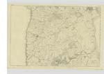
009 | [Situation] Running thro' [through] the N E [North East] corner of the parish of Leswalt A Considerable burn a branch [of] which takes its rise in Loch Connell running in a Southern direction and being Supplied by other branches [particularly] a considerable branch called the Irvie which probably may be considered the principal branch. In its Course generally named after the farms through which it runs in its course the [burns] Supply the Craigach Mills & forms the boundary between the farms of Barbeth & High Salchrie & thence form the boundary between Dinduff and Hill Head & between Dinduff & Soleburn Croft near where it falls into Loch Ryan |
Continued entries/extra info
[Page] 8 -- Parish of LeswaltForm 136
Page 41 - SoleBurn
Transcriber's notes
On Six inch Plan 009Transcribers who have contributed to this page.
Chr1smac -Moderator, HannahLROB
Location information for this page.
Linked mapsheets.