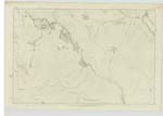
OS1/33/19/61


| List of names as written | Various modes of spelling | Authorities for spelling | Situation | Description remarks |
|---|---|---|---|---|
| BEN MORE ASSYNT | Ben More Assynt (Local) Ben More Assynt (Local) Ben More Assynt (Local) |
"Morrison's Map of Sutherland" Mr. William Ross, L. [Loch] Merkland Mr. James McKay, Corry Kinloch |
072 | The highest hill in the County, situate at the head of the River Cassely. Although the County of Ross comes in, like a tongue, to the southern shoulder, still it may be said that the hill, proper is wholly in Sutherland. |
| CÒINNE-MHEALL | Coinne-mheall Coinne-mheall Coinne-mheall |
Rev. [Reverend] James Joass, Golspie Mr. William Ross, L. [Loch] Merkland Mr. James McKay, Corry Kinloch |
072 | A prominent feature on Ben More Assynt. Sig: [Signification] "Dog, or Gathering Hill" |
| CONIVAL 1-inch Revision October 1894. | Conival (adopted) | See 1-inch Name list submitted to factor of Sh. [Sheet] 108. | 072 | |
| GARBH CHOIRE | Garbh Choire | Rev. [Reverend] James Joass, Golspie Mr. William Ross, L. [Loch] Merkland Mr. James McKay, Corry Kinloch |
072 | A hollow feature, situate on the South east side of "Coinne Mheall" Sig: [Signification] "Rough Corry" |
| ALLT A' GHARBH CHOIRE | Allt a' Gharbh Choire | Rev. [Reverend] James Joass, Golspie Mr. William Ross, L. [Loch] Merkland Mr. James McKay, Corry Kinloch |
072 | A mountan stream rising in the last mentioned Corry [Garbh Choire], and running south-east until it empties itself into Dubh Loch Mòr Sig: [Signification] "Stream of the Rough Corry" |
Continued entries/extra info
[Page] 61Sheet 72 -- Ph. [Parish] of Criech -- Sutherland
Transcribers who have contributed to this page.
KBMW- Moderator
Location information for this page.
Linked mapsheets.