OS1/32/7/27


| List of names as written | Various modes of spelling | Authorities for spelling | Situation | Description remarks |
|---|---|---|---|---|
| Craw Road | Craw Road Craw Road Craw Road Craw Road |
Estate Maps J Begg Factor D. Foyers Knowehead D. Ferguson Shepherd |
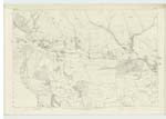
027 | The "Craw Road" is the whole of the Trust Road in this parish from "Balgrochan" (Trace 6. 27-8), to the Parish Boundary at "Moss Maigry" (22.13). It bears the name chiefly from the circuitous form it takes in winding round the western extremity of that range of Hills which are over Lennoxtown, and which are the only actual Fells in the Parish of Campsie among the range of Hills called the "Campsie Fells". These Fells extend from here (the "Craw Road in the west) to the eastern By. [Boundary] of the Parish adjoining "Kilsyth Hills". |
| Alnwick Bridge | Alnwick Bridge Alnwick Bridge Alnwick Bridge Alnwick Bridge Allwick Br. [Bridge] |
Estate Map of Kirkton D. Foyers Knowehead D Ferguson Shepherd J. Begg Factor Estate Map of Woodhead |
027 | A wooden Bridge over Alnwick Burn or Kirk Burn on the line of T.P. [Turn Pike] Road between Lennoxtown and Fintry. It is kept up by the Co. [County] and the Road Trust. Alnwick is generally supposed to be the proper mode of spelling. |
Continued entries/extra info
[Page] 27Co. [County] Stirling -- Campsie Parish
[Note below Craw Road:]
"Craw", a crow.
Transcribers who have contributed to this page.
Alison James- Moderator, Rmgt
Location information for this page.
Linked mapsheets.