OS1/23/20/79


| List of names as written | Various modes of spelling | Authorities for spelling | Situation | Description remarks |
|---|---|---|---|---|
| HOXA HEAD | Hoxa Head Hoxa Head Hoxa Head Hoxa Head Hoxa Head Hoxa Head Hoxa Head Hoxa Head |
Captain Gray, Roeberry W. T. Norquay Esq. [Esquire] Banker St. [Saint] Margt's [Margaret's] Hope Mr. James Dearness Farmer Bow, Andrew Gold Esqr. [Esquire] Factor Kirkwall W.B. Swanson Esq. [Esquire] St. [Saint] Margt's [Margaret's] Hope Handbook to the Orkneys Admiralty Chart Imperial Gazetteer |
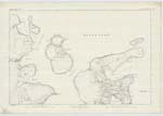
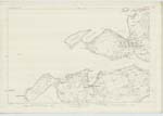
120 | A high headland, the most southwesterly extremity of the promontory or peninsula forming the District of Hoxa, it is situated about 3 miles W. from St. [Saint] Margaret's Hope, and froms the northern boundary to the entrance to Widewall Bay, The property of the Earl of Zetland, |
| SOUND OF HOXA | Sound of Hoxa Sound of Hoxa Sound of Hoxa Sound of Hoxa Sound of Hoxa Sound of Hoxa |
Mr. G. Budge, Farmer, The Quarry, Mr. J. Welldridge Farmer Uppertown W. T. Norquay Esq. [Esquire] Banker St. [Saint] Margt's [Margaret's] Hope Andrew Gold Esqr. [Esquire] Factor Kirkwall W.B. Swanson Esq. [Esquire] St. [Saint] Margt's [Margaret's] Hope Captain John Gray, Roeberry |
119; 120 | An arm of the sea about 3 miles in length and 2 in breadth, situated between the northern expansion of the Pentland Firth and the southern entrance to Scapa Flow, and deviding Hoxa and Hoxa Head from the E. coast of the island of Flota, |
Continued entries/extra info
Parish of South Ronaldshay Orkney.Signed A. McDonald 2nd Corpl. [Corporal] R.E.
Transcribers who have contributed to this page.
Quakecity
Location information for this page.