OS1/11/43/7


| List of names as written | Various modes of spelling | Authorities for spelling | Situation | Description remarks |
|---|---|---|---|---|
| COAL BURN | Coal Burn Coal Burn Coal Burn Coal Burn |
Andrew Gray Thomas GowanS SKetch of RoadS by James Flint Map of County |
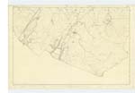
016 | [Situation] Joining Harwood Water a few chains S. [South] of BaadS Mill Bridge A Small Stream, rising in the Moars on the farm of Todholes, it runs in a Northerly direction, and joins Harwood Water Near - Bad's Mill, where there is a Small Seam of Coal. from which the Name is in all probability derived. |
| BENRY BRIDGE | Bennerie Bridge Benry Bridge Benry Bridge Benry Bridge |
Andrew Gray Thomas Gowan Thomas Bauchope Thomas StarK |
016 | [Situation] 1⅜ miles W. [West] S. W. [South West] from the N. [North] end of Cobinshaw Reservr [Reservoir] County ? A Small Pen on the Co. [County] Boundy [Boundary] on the Road from Carnwath to Edinburgh. This name altho [although] applying to a pen & therefore a misnomer, yet is evidently an old & long established name as app[?] from a tradition in the neighbourhood It is said that the devil undertook to construct [2]00 Miles of road for a noted Scotch wizard Michael Scott as quick as the latter could run his house the same distance & that this pen was constructed on this occasion. |
Continued entries/extra info
Parish of West Calder [Page] 7[Note] Altho. [Although] the tradition here recorded is as incredible as it is marvellous, yet it is a proof of the antiquity &. RemarKableness of this object as it is usual in Scotland to attribute the origin of buildings &. other objects of which the origin is not otherwise Known to the Devil, to Michael Scott, or to the Picts. - Notes. It is not a County bridge.
Transcriber's notes
In the Coal Burn entry "Moars" is probably meant to be Moors.In Benry Bridge entry unsure of word beginning app and number of miles.
Transcribers who have contributed to this page.
Molly Miller
Location information for this page.
Linked mapsheets.