OS1/11/33/3


| List of names as written | Various modes of spelling | Authorities for spelling | Situation | Description remarks |
|---|---|---|---|---|
| BLACK HILL | Black Hill West Black Hill |
J Jackson Rev [Reverend] S Moncreiff Co. [County] Map |
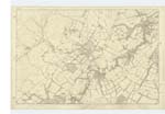
012 | [Situation] About 2¼ Miles N.W. [North West] from Coates. A large hill, part of the farms of Kirkton & Logan House. It is part of the Pentland Range. On its summit is a Trigl [Trigonometrical] Station |
| GASK HILL | Gask Hill | J Jackson Rev [Reverend] S Moncreiff |
012 | [Situation] About 1 Mile & ¾ N.W. [North West] from Coates. A small hill connected to Black Hill by a small ridge of ground |
| LOGAN BURN | Logan Burn Logan House Water Logan Water |
Sir G. Clark Baronet rev [Reverend] S Moncreiff Knox's Co. [County] Map Stat. [Statuary] Act 1845 |
012 | [Situation] ¾ of a Mile West from Carnethy Hill. A small stream running on the farms of Bavelaw, Logan House and Westside and after running easterly a short course runs into the Edinburgh Water Company's Reservoir |
Continued entries/extra info
[Page] 3Parish of Penicuik
[Top Left] In Form 136 Page -
Black Hill: Object Hill Page 23
Gask Hill: Object hill Page 23
Logan Burn Object: Stream Page 24
Transcribers who have contributed to this page.
auntylexa
Location information for this page.
Linked mapsheets.