OS1/11/23/10


| List of names as written | Various modes of spelling | Authorities for spelling | Situation | Description remarks |
|---|---|---|---|---|
| HARWOOD WATER | Harwood Water Harwood Water Harwood Water Harwood Water |
William Black Thomas Gowan Map of Roads County map |
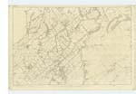
010 | [Situation] Runng [Running] N. [North] thro [through] the parish of West Calder to the River Almond. A Considerable Stream having Source at the base of Hendries C and flowing in a north easterly dir [direction] to its junction with West Calder Burn at this point the river takes the name Willandean [Killandean ?] Burn - Northward - Harwood Water passes under two County Bridges on this plan - There is another small County Bridge over a Drain and about 1/5 of a mile West of Westfield - see examination traces 4 & 5 - |
| LONGSIDE | Langside Langside Long Side Longside Longside Longside |
William Alison Robert Martin County map Map of Roads R.D. Martin J. Inglis |
010 | [Situation] 7/8 mile West from Bellsquarry. A farm house, one story [storey] high, with Suitable offices, a thrashing [threshing] machine, and an arable farm of about 110 acres in extent, attached the property of William Gloag Esq and presently occupied by William Allison |
Continued entries/extra info
[Page] 10Parish of West Calder
In forms 136 page
65
69
Transcriber's notes
Two different spellings of occupant's name "Alison" or "Allison".Transcribers who have contributed to this page.
JCB
Location information for this page.
Linked mapsheets.