OS1/20/135/3


| List of names as written | Various modes of spelling | Authorities for spelling | Situation | Description remarks |
|---|---|---|---|---|
| BLACK STOCKERTON MOOR | Black StocKerton Moor Black StocKerton Moor Black StocKerton Black StocKertoun BlackstocKertoun |
John Craig Thomas Cowan Ainslies Map revd. [revised] 1820 Valuation Roll 1819 |
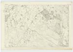
045 | [Situation] About 1 1/2 miles W. [West] by S. [South] of Castle Hill. This is in the Northern Angle of the Parish An extensive tract of moorland on the farm of Black Stockerton consisting of heathy pasture with a few rocks interspersed thro' [through] it. It is the property of the Earl of Selkirk |
| SCAR HILL | Scar Hill Scar Hill Scar Hill |
John Craig James McKittrick Ainslies Map red. [revised] 1820 |
045 | [Situation] about 1 3/4 miles W.S.W. [West South West] of Castle Hill A small rocky hill on the summit of which is a small Fir Plantation south of and adjoining Black Stockerton moor. |
| BLACK ELDRICK | Black Eldrick Black Eldrick |
John Craig Thomas Cowan |
045 | [Situation] 1 1/2 miles S.W. [South West] by W. [West] of Castle Hill A small rocky hill on the farm of Sypeland on the summit of which is a Trig: [Trigonometrical] Station. It is the property of the Earl of Selkirk |
Continued entries/extra info
Parish of Kirkcudbright -- [Page] 3Form 136
Page 19- Black Stockerton Moor
19- Scar Hill
19 - Black Eldrick
Transcribers who have contributed to this page.
Chr1smac -Moderator
Location information for this page.
Linked mapsheets.