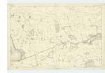
OS1/13/90/17


| List of names as written | Various modes of spelling | Authorities for spelling | Situation | Description remarks |
|---|---|---|---|---|
| GREENHEAD HILL | Greenhead Hill Greenhead Hill Greenhead Hill |
Estate Map of Arnott 1844 Mr. D. Howwie Mr. Beveridge |
023 | [situation] 3/4 Mile N.E. [North East] of Scotlandwell. A green hill on the Farms of Greenhead & Kinneston affording excellent pasture for sheep etc. |
| BACK BURN | Back Burn Back Burn Back Burn Back Burn |
Mr. D. Howie Mr. Beveridge Kinneston Bells Co [County] Map Mr. Scott |
023 | [situation] Running S. [South] Easterly from Greenhead hill. A small stream rising at the north base of Greenhead Hill & flowing in an easterly direction joins Tongue Burn South from West Feal & gets the name of Arnott Burn till it falls into the Leven at Auchmoor Bridge |
| MUNDUFF HILL | Munduff Hill Munduff Hill Munduff Hill |
Mr. Beveridge Mr. D. Howie Mr. Scott Feal |
023 | [situation] 1 Mile N. [North] of Scotlandwell. A feature on the south east side of the Bishop Hill on the Farm of Kinneston |
Continued entries/extra info
17 Plan 23A Portmoak ParishTranscribers who have contributed to this page.
MaxInSpain
Location information for this page.
Linked mapsheets.