OS1/15/3/17


| List of names as written | Various modes of spelling | Authorities for spelling | Situation | Description remarks |
|---|---|---|---|---|
| SOUTH GRAIN | South Grain Burn South Grain Burn |
George Young Robert Murdie |
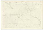
016 | [Situation] Runs in a North easterly direction About a Mile N. by W. [North by West] from Mayshiel. A stream, rising on the farm of Johnscleugh. at the S. [South] East side of Moss Law, and flowing in a N [North] Easterly direction, until it joins the Hazelly Burn at the W. [West] End of Ninestone Rig. |
| TIPPERSTONE RIG | Tipperstone Rig Tipperstone Rig |
George Young Robert Murdie |
016 | [Situation] About 1/2 mile S.W. [South West] from Johnscleugh A low heathy Ridge, on the farm of Johnscleugh, between Rough Cleugh, and Hazelly Burn; |
Continued entries/extra info
[Page] 17Parish of Whittingham
Form 136 Page
39 South Grain Burn
40 Tipperstone Rig
South Grain Burn [note] Grain The branch of a river, the prongs of a fork etc. Jamieson's Scott: Dicty: [Scottish Dictionary]
It would be superfluous to retain the word "Burn" in the above name. Similar names have been hitherto written on the ordnance plans but the word "burn" has never been used.
Transcribers who have contributed to this page.
Trondragirl- Moderator, Douglas Montgomery
Location information for this page.
Linked mapsheets.