OS1/9/14/70


| List of names as written | Various modes of spelling | Authorities for spelling | Situation | Description remarks |
|---|---|---|---|---|
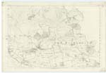
| MILITARY WAY (Continued) | Military Way (Continued | 023 | [continued from page 69] Wood" is said by the authorities to have kept the north side of the fence which runs up from the Road to the Wood. There is no track on this side but there is on the the south of the fence a road partly a Right of Way in connexion with the "Causeway" at Ledcameroch, and principally a road to the Farm of Castlehill (5.23-11). The portion of old road at the north west corner of "Garscadden Wood", well known as the continuation of the "Causeway" from N. [New] Kilpatrick Fort, but not within the extent to which the name applies, as it is used, is a deep hollow now, with a few loose stones scattered about the bottom. This is grown over with close underwood & thorn. The stones in this hollow track are of various sizes, some appearing to have come out of the dike sides enclosing it. From the corner or top of the wood to the strip of plantation (Trace 3.23.15), which runs southwards & joins the wood, where the fences end which enclose the "Causeway", at its west end, there is no track except the Foot path (the Right of Way) which is said to be on the line of Way. From the strip of plantation to the Fort of Kilpatrick, passing Ledcameroch, the road is known to the older people as the "Causeway". It also applies for an indefinite length beyond the Fort. The whole of the parts described as well as the remainder of what it known of the Military Way on the Parish, is upon the authority of the Revd. Dr. [Reverend Doctor] Sym and the other personal authorities. With reference to the M. W. [Military Way] between the Fort at N. [New] Kilpatrick & "Cleddin Burn", the following description from the Caledonia Romana P. [Page] 301 is given, shewing how far the information got on the ground corresponds - "The Military Way diverged considerably (from the Wall) after passing the Cleddin Burn, but on leaving the Peel Glen it again approached the entrenchments - gradually nearing them as they ascended to the Fort in advance (Castlehill). It has been thought, however, that another branch of the Causeway had been conducted along the low grounds, and almost in a straight line towards Kilpatrick, for the purpose of avoiding the adjacent heights - In general the Via closely accompanies the line of the Wall: when the case is otherwise, it has evidently diverged in order to avoid some considerable turn of the works". Nothing whatever is known of the track or line close to the entrenchments at Castlehill. The branch supposed to have taken almost in a straight line to Kilpatrick agrees here very well with the "Causeway", the part at the north-west corner of Garscadden Wood, and the old road to the south of Hutcheson Hill. The ground however is not low on the line of the "Causeway" 'though it is a good deal below the Castlehill Fort. That part of the Causeway running parallel with the Fosse where the latter makes a sharp turn in the field immediately to the west of N. [New] Kilpatrick Village, does not agree with a description of the Way P. [Page] 306 & 307 which says. "A small portion of the Military Way remains indeed, in a state of considerable perfection. within a field immediately to the west of the high-road which passes East Kilpatrick; but as it is now covered to the depth of several inches by earth, and overgrown with grass, nothing of its appearance can be observed without having recourse to the spade; when, however, the surface is removed, the causeway may be perceived, in breadth about 20 feet, & some 18 paces distant from the line of the great ditch - formed of stones of various sizes, small boulders & such like compactly laid together". The distance from the Fosse to the "Causeway" does'nt correspond with the line shewn by the Revd. Dr. [Reverend Doctor] Sym, which may be the branch alluded to above, & there appears to be a mistake here in the Account for the Causeway in the field immediately to the west of the village, in a field, has not been seen by persons cultivating this ground. The Ph. [Parish] Road between Ferguston Farm house (23-16-2), after passing through the Fort, & the remains of the Fosse is also authorized as on the M. [Military] Way, but its western extent is of course indefinite. After crossing the Milngavie Road - the T.P. [Turn Pike] Road, the Ph. [Parish] Road to the south of the Fosse, ascending the hill to Ferguston Muir, as shewn by Dr. [Doctor] Sym, is upon the Way. This is also indefinite eastwards, & has only been applied as far as the point where it takes a bend immediately to the south of the south-western remains shewn of the Rampart or Wall in Ferguston Muir. The Cal. [Caledonia] Romana P. [Page] 310 states that "in Gordon's time the Ditch on Ferguston Muir was fully 30 feet broad & about 20 deep; the M. [Military] Way was likewise very conspicuous passing for some distance within 13 paces of the Wall - now receding from & again approaching towards it". No traces of the Way are to be seen in the Muir, nor is anything known of it from Ferguston Muir to Summerston & Balmuildy at the Kelvin - the Boundary of the Parish of New Kilpatrick. |
Continued entries/extra info
[Page] 70Co. [County] Dumbarton & Stirling -- New Kilpatrick
Transcribers who have contributed to this page.
Alison James- Moderator, Jim-B
Location information for this page.
Linked mapsheets.