OS1/9/10/46


| List of names as written | Various modes of spelling | Authorities for spelling | Situation | Description remarks |
|---|---|---|---|---|
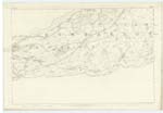
| Remains of Fosse or Ditch of Roman Wall } Continued | 024 ; 025 | The Track of the Ditch of the Roman Wall, which may be traced by a hollow in the ground, varying as described on the preceding page, where it enters this Parish on the eastern Boundary, coming from "Croy Hill" in Cumbernauld Parish, as identified by the Estate Map of Gartshore, Captain Murray Gartshore Pr. [Proprietor], and William Wallace Esqr. of Auchinvole, may be traced to the Farm of "Bar" on the west side & near to the bottom of "Bar Hill". (The part described comprises Trace 3. 25-2. Trace 1 and 2 25-3) Beneath the conical point of "Castle Hill" which is a prominent feature of the "Bar Hill", and a few chains to the eastward it is steeper than at any other part of the Ditch in the Parish. This part is also very remarkable from the Toll Road to Kilsyth, which lies to the east, about the bottom of the Hill, being seen to great advantage as it (the Ditch) ascends the side of the Hill to the sharp point of "Castle Hill". Following the course of the Wall westwards to the Bar farm, there is an Occupation Road formed upon the Fosse; and this Road is, particularly at the Steading, some 6 or 8 or 10 feet below the surface of the fields on either side, shewing unmistakeable evidence of the depth of the Ditch. From the farm of Bar to the "Coke Works" south-west of Twechar (Trace 5. 25-2) all traces are filled in and the course, as before mentioned, merely conjectured. From the "Coke Works" to the point where the "Forth & Clyde Canal" crossed the line of wall in direction of "Shirva" (Trace 4. 25.2) an old Public Road is formed in the Fosse, part of which is only faintly to be seen at intervals and the road itself is in some places sunk below the level of the fields on both sides. This portion was identified by Dr. [Doctor] Stewart of Kirkintilloch & John Cross of Gartshore. About Shirva, which is famed for the numerous Roman Sculptured Remains found in its neighborhood, & as stated in the Caledonia Romana (Page 327) of the existence of a Tumulus, of which no traces appear, nor is there anything known in the locality nor by persons who have to some extent studied the Antiquities of the northern Wall. It is mentioned in the Cal. [Caledonia] Romana (P. [Page] 327) that it "seems exceedingly probable that the vicinity of Shirva had been selected as the burial place of the neighboring garrisons whether it be that the monuments of their dead had stood amid the abodes of men, or in the solitude & silence of the adjacent thickets". ____ There is but a very slight portion of the north side of the Fosse now remaining at Shirva, & this has been shewn upon the authority of Dr. [Doctor] Stewart. At "Wester Shirva", as pointed out on the authority of Mr. J. Maitland Pr. [Proprietor], slight traces of the south side of the Ditch are to be seen on the east of the Steading (Trace 4. 25-2). Retracing from this point, back to Shirva, the line of Wall or Ditch is said to be indicated by a different appearance in the soil, but this is only seen for a short distance between the |
Continued entries/extra info
[Page] 46Co. [County] Dumbarton -- Kirkintilloch Parish
Transcriber's notes
Continued from page 45Continued on page 46
Transcribers who have contributed to this page.
Alison James- Moderator
Location information for this page.