OS1/9/5/25


| List of names as written | Various modes of spelling | Authorities for spelling | Situation | Description remarks |
|---|---|---|---|---|
| Remains of the WALL OF ANTONINUS PIUS | Remains of Fosse or Ditch of Roman Wall Remains of Fosse or Ditch of Roman Wall Remains of Fosse or Ditch of Roman Wall Remains of Fosse or Ditch of Roman Wall Remains of Fosse or Ditch of Roman Wall Remains of Fosse or Ditch of Roman Wall Remains of Fosse or Ditch of Roman Wall Remains of Fosse or Ditch of Roman Wall Remains of Fosse or Ditch of Roman Wall Remains of Fosse or Ditch of Roman Wall Remains of Fosse or Ditch of Roman Wall |
Caedonia Romana Chalmers' Caledonia New Statl. [Statistical] Account Revd. [Reverend] H. Park. Parish Minister A Kirkwood. Farmer. Garnhall James Forrester. Farmer Tollpark William Chalmers. Farmer Arniebog Thomas Allan. Farmer Westerwood William Stark. Easter Dullatur T. Duncan. Wester Dullatur John Cooper. Over Croy William Brown. Langhill |
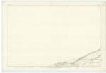
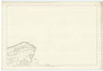
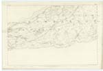
019 ; 020 ; 025 | " For the last two hundred & fifty years, the site of the great northern Rampart - known as the wall of Antoninus, from its having been constructed in his reign - has commanded the attention of not a few amongst those of our national Antiquaries whose ardour led them to penetrate the recesses of the land - ** And seldom since the eye of the inquiring visitant first rested on the dilapidated traces of this ancient barrier, have many years been added in succession to the 'measure' of its age, without one accidental Circumstance or another exposing to light some fresh memorials of its Roman constructors; whose individual names appear at times before us in sculpture as fresh as if the work of recent years, while the grandeur of their united labours has crumbled into dust. This great work, then, consisted in the first place of an immense fosse or ditch - averaging about forty feet in width by some twenty in depth - which extended over hill and dale in one unbroken line, from sea to sea. Behind this ditch, on its southern side, and within a few feet of its base, was raised a rampart of intermingled stone and earth, strengthened by sods of turf; which measured, it is supposed, about twenty feet in height, and twenty-four in thickness at the base. This rampart or agger was surmounted by a parapet, behind which ran a level platform, for the accomodation of its defenders. To the southward of the whole was situated the Military Way - a regular Causewayed road, about twenty feet wide - which kept by the course of the wall at irregular distances approaching in some places, and in others receding to a considerable distance. Along the whole line , from W. [West] Kilpatrick to Carriden, there were established, it is believed, nineteen principal Stations or Forts; we cannot be quite certain of the number, because, towards the east end of the wall, the traces of their existence have for two centuries at least, been either very indistinct or entirely obliterated. Along these intervals were placed many smaller Castella or Watch Towers, of which only some two or three could be observed in the year 1755. While the contiguous rampart seems to have been little more than a well formed earthern mound, it is probable that many if not all the Stations were revetted with stone or entirely built of that material. In some places it would even appear that the vallum itself had been raised upon a stone foundation - probably in situations where the ground was low and marshy, and where it was necessarry to form drains beneath the works to prevent the accumulation of water on their interior side. Genl. [General] Roy supposes the ditch to have constituted the chief strength of the whole, and seems to consider the agger itself as having been of very secondary importance. He was evidently led to this opinion from the insignificant appearance which even the best preserved of its sections presented when he saw them; it must however be borne in mind as a circumstance highly probable, that the rampart, was, in course of time, much more liable to be demolished than the fosse to be filled up - hence perhaps, the distinct appearance of the one compared with the other." Caledonia Romana. The remains of the ditch of the Roman Wall, better known to the Country people as "Graham's Sheugh", is, on the whole, in good preservation in Cumbernauld. Every Farmer or resident, near the line of wall, knows it. In the rough rocky grounds of Croy Hill, (Plan 025.3 and 019A.16) and in some wooded portions on the lands of Westerwood, and Easter Dullatur ( 019A.16 and 020.13.) the remains are almost perfect. Throughout the greater part of the Parish the ditch has, in some measure, been preserved by being formed into the borders of fields. The Edinburgh & Glasgow Railway crosses it in two places - at Castlecary and Easter Dullatur, and in both cases has obliterated all traces for a short distance on either side. Croy Hill is the only place in the Parish where any plain remains of the rampart exist. This portion stands upon an eminence or natural Knowe, on the highest part of the Hill, and is seen from many places in the district. On the top of the rampart there is a level track, 7 or 8 feet wide, from which it now slopes regularly on each side to the bottom - that side next to the ditch, mingling with it, at one part, as one unbroken Embankment or slope. /over [continued on page 26] |
Continued entries/extra info
[Page] 25Dumbartonshire -- Cumbernauld Parish
See Descriptive Remarks, compiled from
Roy's Military Antiquities, Chalmer's Caledonia,
and Caledonia Romana, in reference to this
Wall - in Name Book of Cadder Parish -
Lanarkshire.
R.H.
[Alongside descriptive remarks:]
Caledonia Romana Page 269
Caledonia Romana Pages 278 & 9
Caledonia Romana Pages 278/9
Transcribers who have contributed to this page.
Alison James- Moderator, Molly Miller
Location information for this page.