OS1/10/50/74


| List of names as written | Various modes of spelling | Authorities for spelling | Situation | Description remarks |
|---|---|---|---|---|
| STODDLE GRAIN | Stoddle Grain Stoddle Grain Stoddle Grain |
William Carruthers Farmer William Bell Shepherd William Laidlaw Shepherd |
025 | A small stream having its source on the North side of Laverhay Height, it falls into Raggin Gill. |
| THE CRAIG | The Craig The Craig The Craig |
William Carruthers Farmer William Bell Shepherd William Laidlaw Shepherd |
025 | A long Craig or Rock on Laverhay Farm and on the East side of Wamphray Water |
| THOR BECK | Thor Beck Thor Beck Thor Beck |
William carruthers Farmer William bell Shepherd William Laidlaw Shepherd |
025 | A small stream having its source on the West of Laverhay Height it falls into Wamphray Water |
Continued entries/extra info
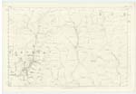
74 Parish of Wamphray Plan 25.6 Trace 3Entry for The Craig is scored out
Thor Beck situation From 12 Chains North West of Wether Lairs, West to Wamphray Water.
Stoddle Grain situation From the North West side of Laverhay Height, North West to Raggit Gill
Charles J Fearnside Sapper Royal Engineers
Transcribers who have contributed to this page.
stellas
Location information for this page.
Linked mapsheets.