OS1/10/50/17


| List of names as written | Various modes of spelling | Authorities for spelling | Situation | Description remarks |
|---|---|---|---|---|
| EAST KNOWE | East Knowe | C Stewart Esq Hillside Mr W Carruthers (Laverhay) William Johnstone (Shepherd Garrowgill) |
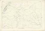
017 | [Situation] At the N. En [North Eastern] point of this Parish An eminence of great height Situated on the East side of Lochfell - |
| LOCH FELL | Lochfell Loch Fell Loch Fell Loch Fell |
C Stewart Esq Mr W Carruthers W Johnston Johnston's County Map Crawford's County Map Blackwood's County Map |
017 | [Situation] On the boundary between Wamphray and Moffat - A hill of great elevation Situated at the northern extremity of the Parish of Wamphray, and on the Summit of which the Parishes of Eskdalemuir, Moffat, Hutton and Wamphray in Dumfriesshire all meet - and from the base of which the waters flow into Moffat, Dryfe and Wamphray on Annandale - the Esk in Eskdale and the Ettrick in Selkirkshire. |
Continued entries/extra info
[Page] 17 -- Parish of Wamphray -- Sheet 17 No 11 Trace 1[Signed]
Thomas Watson
2nd Corp: R. E. [Corporal Royal Engineers]
Transcribers who have contributed to this page.
Chr1smac -Moderator, stellas
Location information for this page.
Linked mapsheets.