OS1/10/48/7


| List of names as written | Various modes of spelling | Authorities for spelling | Situation | Description remarks |
|---|---|---|---|---|
| WATER OF MILK | Water of Milk Water of Milk Water of Milk |
John Common Crossdykes Richard Common Crossdykes William Davidson Crathet |
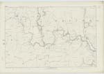
035; 043; 044; 051; 052 | [Situation] On the Wn. [Western] Parish Boundary. Rises in the north-east extremity of Tundergarth, it arrives 1 1/2 miles from its source at the northern boundary of that parish, and thence over a distance of 9 1/2 miles, it divides Tundergarth on its left bank, from Hutton and Corrie, Dryfesdale & St. Mungo on its right. Leaving Tundergarth it flows southward 2 1/2 miles through St. Mungo and 1 mile between that Ph. [Parish] and Hoddam to the Annan, half a mile above Hoddam Castle. |
| GLAISTER BURN | Glaister Burn Glaister Burn Glaister Burn |
John Common Richard Common William Davidson |
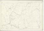
044 | [Situation] 1/2 mile N. [North] from Percy Hill. A small stream which rises near the Dod Hill, on the farm of Crossdykes, and runs into the Milk. |
Continued entries/extra info
[Page] 7Parish of Tundergarth -- Sheet 44.2 Trace 1
[Signed] John Jane
Sapper R.E. [Royal Engineers]
Transcribers who have contributed to this page.
CorrieBuidhe- Moderator, Brenda Pollock
Location information for this page.
Linked mapsheets.