OS1/10/44/149


| List of names as written | Various modes of spelling | Authorities for spelling | Situation | Description remarks |
|---|---|---|---|---|
| BROWN HILL | Brown Hill Brown Hill Brown Hill Brownhill |
James Kerr James Dalziel David Tenant Black,s map of Dumfries |
007 | A Considerable hill near Glendyne the name has been established many years. "It is more than 1000ft. [feet] above the level of the Sea," |
| GLENCRAIGY | Glencraigie Glencraigie Glencraigie Glencraigy Craigy - Rocky |
James Kerr James Dalziel Estate Map Revd. Dr. [Reverend Doctor] Simpson Sanquhar, Dr. [Doctor] Jamieson |
007 | A rugged glen through which a Stream runs. This stream rises on Brown hill and falls into Glendyne Burn. |
| GLENDYNE BURN | Glendyne Burn Glendyne Burn Glendyne Burn |
James Kerr James Dalziel Estate Map |
006; 007 | A Small Rivulet which rises near Wanlockhead and runs through Glendyne at length falling into Mennock Water. |
Continued entries/extra info
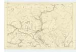
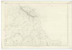
[page] 149Parish of Sanquhar -- Plan 7.9 Trace 1
[BROWN HILL - Situation:]
3½ miles N.E. [North East] by E. [East]
from Sanquhar
[GLENCRAIGY - Situation:]
From N.W. [North West] slope of
Brown Hill N.W. [North West]
to Glendyne Burn.
[GLENDYNE BURN - Situation:]
From the South En. [Eastern]
base of Stood Hill
S.W. [South West] by South to Menock Water.
[Page is signed:]
Philip Munro
Pt [Private] RS&M [Royal Sappers and Miners]
Transcribers who have contributed to this page.
Nora Edwards, George Howat
Location information for this page.