OS1/10/27/41


| List of names as written | Various modes of spelling | Authorities for spelling | Situation | Description remarks |
|---|---|---|---|---|
| MID PIKE | Mid Pyke Mid Pyke Mid Pyke |
David Carruthers, Waterhead George Carruthers Waterhead George Henry Waterhead |
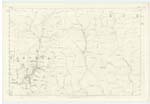
025 | [Situation] On the Boundary between Eskdalemuir and Hutton and Corrie An eminence of great altitude situated at the N.E. [North East] extremity of the farm of Waterhead. |
| CALFSHAW RIG | Calfshaw Rig Calfshaw Rig Calfshaw Rig |
David Carruthers Gearge Carruthers George Henry |
025 | [Situation] South of Mid Pike. A hill of a ridge like shape near the N.E. [North East] side of the farm of Waterhead. |
| LITTLE PIKE | Little Pike Little Pike Little Pike |
David Carruthers George Carruthers George Henry |
025 | [Situation] On the boundary between Eskdalemuir and Hutton and Corrie. An eminence of Considerable height, and Commands a fine view to the south including the whole vale of the Annan to its junction with the Solway Firth. |
Continued entries/extra info
[Page] 41Parish of Hutton & Corrie -- Plan 25.12 Trace 1
Mid Pike [note] - See below
Little Pike [note] Pike - the usual mode of spelling recommended in this County and generally adopted on Maps.
[Signed] Philip Munro
Lce. Corp. R.E. [Lance Corporal Royal Engineers]
Transcribers who have contributed to this page.
CorrieBuidhe- Moderator, norma
Location information for this page.
Linked mapsheets.