OS1/10/27/108


| List of names as written | Various modes of spelling | Authorities for spelling | Situation | Description remarks |
|---|---|---|---|---|
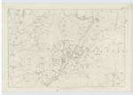
| DRYFE WATER | Dryfe Water Dryfe Water Dryfe Water |
Fullartons Imperial Gazetteer Johnston's County Map Blackwoods County Map |
034 | [Situation] From near the Nn. [Northern] point of Parish S.S.W. [South South West]. A considerable stream rising at the South foot of Loch Fell in the North point of the parish. |
Continued entries/extra info
[Page] 108Parish of Hutton & Corrie -- Plan 34.10 Trace 4
Millrigg Bank [crossed out.] See adj. [adjacent] Plan
[Signed] Charles J. Fearnside
S.R.E. [Sapper Royal Engineers]
Transcribers who have contributed to this page.
CorrieBuidhe- Moderator, norma
Location information for this page.
Linked mapsheets.