OS1/10/21/69


| List of names as written | Various modes of spelling | Authorities for spelling | Situation | Description remarks |
|---|---|---|---|---|
| TERERRAN BURN | Tererran Burn Terraran Terreran |
David morrine John Barber Esqr. Robert mc Turk Esqr. Valuation roll 1827 Johnstone's County map |
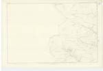
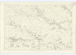
030 | [Situation] On En. [Eastern] Parish Boundary running South- West A small Burn rising on the farm of Tererran, passing the farm House it falls into the Dalwhat Water |
| DALWHAT WATER | Dalwhat Water | David morrine John Barber Esqr. Robert mc Turk Esqr. |
020; 029; 030 | [Situation] From Northern Parish Boundary running S,E, [South East] to a point ½ mile S,E, [South East] of Minnyhive , A Small river taking its course at Cairn Head where Dabin Burn Blairoch Burn & Glengow Burn Join. It joins the Cairn Water about half a mile from minny hive |
| TERERRAN BRIDGE | Tererran Bridge (Stone) | David morrine John Barber Esqr. Robert mc Turk Esqr. |
030 | [Situation] About 2 miles N,W, [North West] from Minnyhive, A one arched stone Bridge across Dalwhat Water, built at the expense of John Barber Esqr. Proprieter of Tererran |
Continued entries/extra info
[Page] 69Parish of Glencairn -- Plan 30 —10 Trace 1
[Signed] P. Connell
Pte. Rs,&.m [Private Royal Sappers and Miners]
Transcribers who have contributed to this page.
mac1
Location information for this page.