OS1/10/21/211


| List of names as written | Various modes of spelling | Authorities for spelling | Situation | Description remarks |
|---|---|---|---|---|
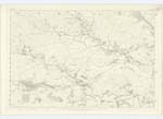
| JARBRUCK BURN | Jerbruck Burn Jerbruck Burn Jerburgh Burn Jerbrugh Burn Jedburghe Burn Jarbruck Burn Jarbruck Burn |
John Dunkeld Robert Kerr. Black's Co. [County] Map of Dumfries Valn. [Valuation] Roll of 1827. Ancient Valn. [Valuation] Roll N. Graham = Graham Esqre. Jarbruck Plans and Property Writings |
030; 039 | [Situation] From the South of Dalmacallan Hill N. E. [North East] to Cairn Water A small streamlet which has its rise on the Moorland of Jerbrugh and runs in a N.W. [North West] course into Cairn Water, |
| DALMACALLAN HILL | Jerbruck Hill Jerbruck Hill Dalmacallan Hill Dalmacallan Hill |
John Dunkeld Robert Kerr N Graham= Graham Esqre. Property Plans. |
039 | [Situation] About 2¼ miles S,E, [South East] by S. [South] from Moniaive , A hill feature on the moorland of Jerbrugh, so named in the District. This is called Dalmacallan Hill It originally formed the pasture land of the Farm of Dalmacallan, hence the Name. |
Continued entries/extra info
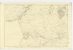
[Page] 211,Parish of Glencairn -- Plan 39. 7 Trace, 2,
[Signed] M. Donohue June 1856.
Transcribers who have contributed to this page.
mac1
Location information for this page.