OS1/10/20/159


| List of names as written | Various modes of spelling | Authorities for spelling | Situation | Description remarks |
|---|---|---|---|---|
| COOMS | Cooms Cooms Cooms Coums |
John OGilvie Cooms Thomas Rutherford Lodge Gill John Jardine Arkleton Johnston's County Map |
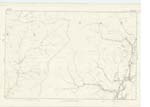
037 | [Situation] About 1/2 mile nearly South from Lodgegill. A farm house with garden and farm of land attached occupied by John OGilvie Proprietor, Joseph Lamb Esqr. |
| YELLOW SIKE | Yellow Syke | John Ogilvie Farmer Cooms Simon Rutherford Shepherd Lodgegill |
037 | [Situation] A little West of Coombs. A small stream having its source on Ewe Rig, flowing in an easterly direction down the east side of the above rig, and falling into Tarras Water immediately on the west side of Cooms. |
| BUGHT RIG | Bught Rig | John Ogilvie Farmer Cooms Simon Rutherford Shepherd Lodgegill |
037 | [Situation] Nearly 1/2 mile East of Ewe Rig. A small ridge on the farm of Cooms, the surface of which is arable & rough pasture, it extends from Sheil Syke to Tarras Water |
| COOMS BURN | Cooms Burn | Described on Sheet 37 No. 10 |
Continued entries/extra info
[Page] 159Parish of Ewes -- Plan 37 -- [No.] 9 -- Trace 5
[Signed] Michael Henigan
Transcribers who have contributed to this page.
CorrieBuidhe- Moderator, georgelaidlaw
Location information for this page.