OS1/10/19/25


| List of names as written | Various modes of spelling | Authorities for spelling | Situation | Description remarks |
|---|---|---|---|---|
| STELL BUSH EDGE | Stell Bush Edge Stell Bush Edge |
Matthew Little Shepherd Pengrain James Glendinning Farmer Over Cassock |
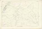
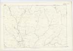
017; 018 | [Situation] About 1/2 Mile E. by S. [East by South] of White Shank This name applies to a portion of land situated between Summercleugh Knowe and Great Brow the surface of which is Moss and Rough Pasture |
| DAVINGTON BURN | Davington Burn Davington Burn Davington Burn |
Matthew Little Shepherd Pengrain James Glendinning Over Cassock Johnston's Co. [County] map |
017; 018 | [Situation] About 25 Chains East of White Shank A Burn which has its source from the base of Ettrick Pen flowing in a Southerly direction till it enters the River Esk at Davington |
Continued entries/extra info
[Page] 25Parish of Eskdalemuir
Sheet 17 No. 4 Trace 6
Stell Bush Edge [note] - Stell, A covert, A Shelter, an enclosure for cattle
Jamieson
Transcribers who have contributed to this page.
CorrieBuidhe- Moderator, gengirl44
Location information for this page.