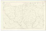
OS1/10/6/5


| List of names as written | Various modes of spelling | Authorities for spelling | Situation | Description remarks |
|---|---|---|---|---|
| GLENBUITH | Glenbuith Glenbuith Glenbuith |
John Mitchell Townfoot William Gardiner Townhead Joseph Brown Kettletonhead Buccleuch Estate Maps and documents. |
023 | [Situation] At the S,E, [South East] side of Garroch Fell, A long deep glen with a stream flowing through it which rises at the north-east end of Garroch Fell, and flows in a southern direction until it falls into Garroch Water |
| GARROCH FELL | Garroch Fell Garroch Fell Garroch Fell Garroch Hill Garroch Fell |
John Mitchell Joseph Brown Thomas Nevison Burn Johnston's County Map New Statl [Statistical] Account of Dumfriesshire |
023 | [Situation] In Nn[Northern] district of this Parish. A ridgelike hill, considerably above 1000 feet in altitude, it is the highest in the Ph [Parish] with the exception of Queensberry |
| SNAPPERS SLACK | Snappers Slack Snappers Slack Snappers Slack |
Adam Menzies. Garroch Peter McMorrin. Midtown Andrew Jardine. Burleywhag |
023 | [Situation] On Garrow Fell. A dry hollow or Cleuch on Garroch Fell, derivation not known |
Continued entries/extra info
[Page] 5Parish of Closeburn -- Plan 23-1 -- Trace 4
[signed] W. Paterson c/a [Civilian Assistant]
Transcribers who have contributed to this page.
Moira L- Moderator, Rootsforyou
Location information for this page.
Linked mapsheets.