OS1/5/9/1


| List of names as written | Various modes of spelling | Authorities for spelling | Situation | Description remarks |
|---|---|---|---|---|
| COLDINGHAM [parish] | Coldingham Parish |
Fullarton's Gazetteer New Statistical Account |
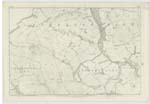
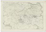
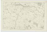
002 ; 004 ; 005 ; 006 ; 011 | This parish (with the exception of a small detached portion that is locally situated in the parish of Eyemouth) is in the district of Lammermoor in Berwickshire and is one of the largest in the county It is bounded on the north by the German Ocean, on the east by the German Ocean and the parishes of Ayton and Eyemouth, on the south by the parishes of Chirnside and Buncle, and on the west by those of Abbey St Bathans, Old Hamslocks, and Cockburnspath. The parish takes its name from the village of Cockburnspath - the etymology of which cannot be easily traced. The author of "Caledonia" traces it to cold den and ham, signifying 'The village in the cold vale' The writer of "New Stat. [Statistical] Acct [Account]" traces it to the same roots Others derive it from Col ing & ham - "The village on the cold common". While the author of the "History of Coldingham" supposes it to be a corruption of Coll-ann & ham i.e. "The village at the gathering or meeting of the waters" Previous to the Reformation the name Coldingham-shire - Schire or Scire - (which in the Gaelic language signifies a Parish and is spelt Sgire) was applied to a large tract of country contiguous to the parish of Coldingham and comprehending the most part of the parish by which it is, for the most part, very uneven. Several ranges of hills - constituting part of the Lammermoor chain - run through it in a parallel line from west to east, and fall off to the north to form the celebrated promontories of St Abbs and Fast Castle. The principal waters in the parish are Coldingham Loch (Page 47. Bk No 9 and the rivers Ale (P [Page]105 Bk [Book] No2) and Eye (P [Page] 81 Bk [Book] No2) (turn over) |
Continued entries/extra info
1Transcribers who have contributed to this page.
DANIALSAN, ron hill
Location information for this page.
Linked mapsheets.