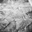
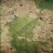
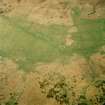
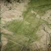
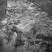
Oblique aerial view centred on the remains of the farmstead and field system with dun, settlement, hut-circle and burnt mounds adjacent, taken from the W. View in Canmore
Forse House, ND23SW 9, Ordnance Survey index card, page number 1, Recto View in Canmore
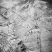
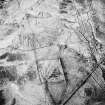
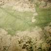
Oblique aerial view centred on the remains of the farmstead and field system with dun, settlement and burnt mounds adjacent, taken from the SSE. View in Canmore
Oblique aerial view centred on the remains of the farmstead and field system with dun, settlement, hut-circle and burnt mounds adjacent, taken from the W. View in Canmore
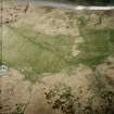
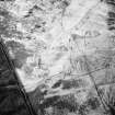
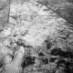
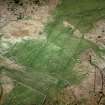
Oblique aerial view centred on the remains of the farmsteads, field system and burnt mounds, taken from the SE. View in Canmore
Oblique aerial view centred on the remains of the farmstead and field system with dun, settlement, hut-circle and burnt mounds adjacent, taken from the W. View in Canmore
Oblique aerial view centred on the remains of the farmsteads, field system and burnt mounds, taken from the SE. View in Canmore
You may copy, display, store and make derivative works for personal use or use solely within an educational institution by staff and students, under these conditions: the ScotlandsPlaces website is attributed, there is no commercial use or sale, and no public distribution (for example, by hand, email, or web). Full licence details.