
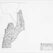
Tankerness, Mine Howe


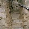
Section through the subterranean chamber.
View in Canmore
View in Canmore

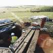
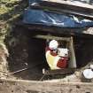
Commission at work: Mr D Cowley and Mr R Shaw at entrance to subteranean structure (with Historic Scotland staff).
View in Canmore
View in Canmore

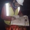
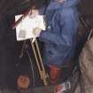
Commission at work: Mr I Parker with plane table on half-landing of subterranean structure.
View in Canmore
View in Canmore

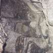
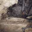
Detail of junction of slab floor of cistern and side walls showing bones and smears of charcoal.
View in Canmore
View in Canmore

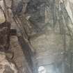
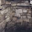
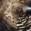
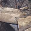
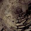
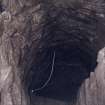
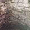
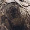
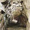
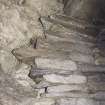
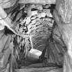
View of corbelled roof in the lower chamber (cistern).
View in Canmore
View in Canmore

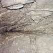
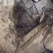
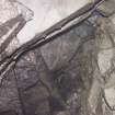
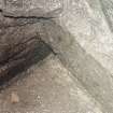
View into void above the upper flight of steps showing junction of natural and drystone walling.
View in Canmore
View in Canmore

Section through subterranean structures at Mine Howe
View in Canmore
View in Canmore

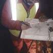
Commission at work: Mr I Parker carrying out plane table survey in the cistern (lower chamber).
View in Canmore
View in Canmore

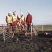
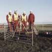
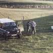
Commission at work: survey team (L to R - Mr Ian Parker, Mr Rob Shaw, Mr Dave Cowley and Mr John Keggie) at entrance to subterranean structure.
View in Canmore
View in Canmore

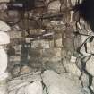
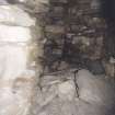
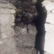
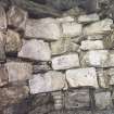
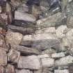
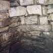
View of walling in cistern (lower chamber).
View in Canmore
View in Canmore

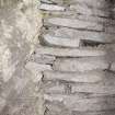
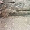
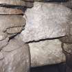
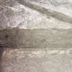
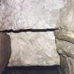
Detail of junction of drystone walling and natural boulder clay on half landing.
View in Canmore
View in Canmore

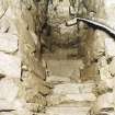
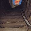
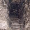
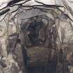
View along the half landing down the lower flight of steps to the lower chamber (cistern). The smaller side gallery is on the right.
View in Canmore
View in Canmore

View looking up lower flight of steps from cistern to half landing, with Mr R Shaw.
View in Canmore
View in Canmore

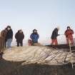
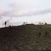
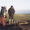
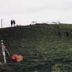
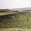
View of the natural mound of Mine Howe, with Mr I Parker and Mr R Shaw with Douglas Patterson, farmer.
View in Canmore
View in Canmore

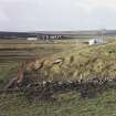
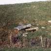
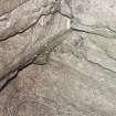
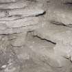
View of sandstone blocks on the S flank of Long Knowe.
View in Canmore
View in Canmore

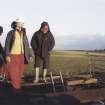
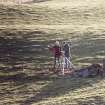
Commission at work: Mr I Parker and Mr R Shaw with GPS at base station.
View in Canmore
View in Canmore

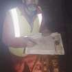
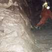
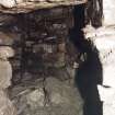
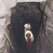
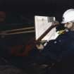
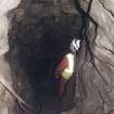
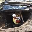
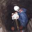
Commission at work: Mr I Parker at work in the entrance to the subterranean structure.
View in Canmore
View in Canmore

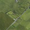
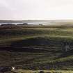
Oblique aerial view centred on Mine Howe, taken from the SSE.
View in Canmore
View in Canmore

Oblique aerial view centred on Mine Howe with St Ninian's Chapel adjacent, taken from the NNW.
View in Canmore
View in Canmore

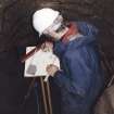
Commission at work: Mr I Parker at entrance to the subterranean structure (with Historic Scotland staff).
View in Canmore
View in Canmore

View down lower steps into cistern (grey pipe is air supply into the cistern).
View in Canmore
View in Canmore

View looking up from half landing, with boulder clay on left and detail of the two lintels spanning void over upper flight of steps.
View in Canmore
View in Canmore

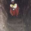
View up ladder steps to surface with Mr I Parker.
View in Canmore
View in Canmore

Detail of junction of slab floor of cistern and side walls showing bones and smears of charcoal.
View in Canmore
View in Canmore

Detail of junction of slab floor of cistern and side walls showing bones and smears of charcoal.
View in Canmore
View in Canmore

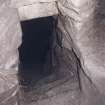
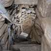
View along smaller, or lower, side gallery which opens out from half landing.
View in Canmore
View in Canmore

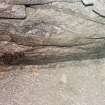
View of horizontally bedded, natural sandstone blocks on the S flank of Long Knowe, to the W of Mine Howe.
View in Canmore
View in Canmore

Commission at work: Mr I Parker and Mr R Shaw with GPS at base station.
View in Canmore
View in Canmore

View looking upwards from the lower chamber (cistern) into the corbelled roof.
View in Canmore
View in Canmore

Commission at work: Mr I Parker at work in the entrance to the subterranean structure.
View in Canmore
View in Canmore

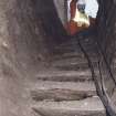
View up lower flight of steps from cistern to half-landing, after installation of handrail.
View in Canmore
View in Canmore

Oblique aerial view centred on Mine Howe with St Ninian's Chapel adjacent, taken from the SW.
View in Canmore
View in Canmore

View down lower flight of steps to cistern, after installation of handrail.
View in Canmore
View in Canmore

View up lower flight of steps from cistern to half-landing, after installation of handrail.
View in Canmore
View in Canmore

Profile through subterranean structures at Mine Howe
View in Canmore
View in Canmore

Commission at work: Mr I Parker with plane table on half-landing of subterranean structure.
View in Canmore
View in Canmore

Commission at work: Mr I Parker with plane table on half-landing of subterranean structure.
View in Canmore
View in Canmore

View looking upwards from half-landing to 'relieving arch' above upper ladder steps.
View in Canmore
View in Canmore

Detail of junction of slabs forming floor of cistern and walling showing bones and smears of charcoal.
View in Canmore
View in Canmore

View along smaller, or lower, side gallery which opens out from half landing.
View in Canmore
View in Canmore

View into void above the upper flight of steps showing junction of natural and drystone walling.
View in Canmore
View in Canmore

View of the smaller and lower of the two side galleries opening out from the half landing.
View in Canmore
View in Canmore

View up into corbelled roof of lower chamber.
View in Canmore
View in Canmore

View up upper flight of ladder steps.
View in Canmore
View in Canmore

Oblique aerial view centred on Mine Howe, taken from the SSE.
View in Canmore
View in Canmore

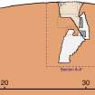
Composite illustration showing schematic section through mound (scale approximately 1:333), detailed plan and section (at 1:50) through chamber of subterranean structure.
View in Canmore
View in Canmore

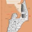
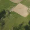
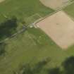
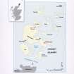
Location map showing Mine Howe and Broch of Gurness.
View in Canmore
View in Canmore

Commission at work: Mr I Parker at entrance to the subterranean structure (with Historic Scotland staff).
View in Canmore
View in Canmore

View down lower flight of steps into cistern (lower chamber). (Grey pipe is air supply).
View in Canmore
View in Canmore

Detail of lintels above lower steps.
View in Canmore
View in Canmore

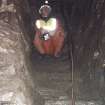
Mr R Shaw in the lower chamber (cistern), seen from the lower flight of steps leading down from the half-landing.
View in Canmore
View in Canmore

Detail of walling in the lower chamber (cistern).
View in Canmore
View in Canmore

View looking up to half landing from the lower chamber (cistern), with Mr R Shaw.
View in Canmore
View in Canmore

View of sandstone blocks on the S flank of Long Knowe.
View in Canmore
View in Canmore

Commission at work: Mr I Parker and Mr R Shaw with GPS at base station.
View in Canmore
View in Canmore

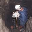
Commission at work: Mr I Parker carrying out a plane-table survey in the subterranaen structure.
View in Canmore
View in Canmore

Detail of the two lintels spanning void over upper flight of steps.
View in Canmore
View in Canmore

View along the lower and smaller of two side galleries opening out from the half landing.
View in Canmore
View in Canmore

Mr R Shaw in the lower chamber (cistern), seen from the lower flight of steps leading down from the half-landing.
View in Canmore
View in Canmore

Detail of walling in the lower chamber (cistern).
View in Canmore
View in Canmore

View of the natural mound of Mine Howe, with Mr I Parker and Mr R Shaw with Douglas Patterson, farmer.
View in Canmore
View in Canmore

Commission at work: Mr I Parker and Mr R Shaw with GPS at base station.
View in Canmore
View in Canmore

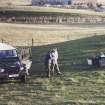
Mr Douglas Patterson, farmer, at entrance to subterranean structure.
View in Canmore
View in Canmore

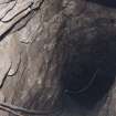
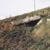
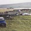
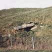
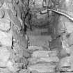
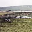
View of Mine Howe with entrance to subterranean structure..
View in Canmore
View in Canmore

Commission at work: Mr I Parker at work in the entrance to the subterranean structure.
View in Canmore
View in Canmore

Tankerness, Mine Howe, HY50NW 38, Ordnance Survey index card, Recto
View in Canmore
View in Canmore

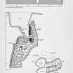
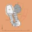
Plan of subterranean structures at Mine Howe
View in Canmore
View in Canmore

Commission at work: Mr I Parker carrying out plane table survey in the cistern (lower chamber).
View in Canmore
View in Canmore

Commission at work: Mr I Parker carrying out plane table survey in the cistern (lower chamber).
View in Canmore
View in Canmore

Commission at work: Mr I Parker carrying out plane table survey in the cistern (lower chamber).
View in Canmore
View in Canmore

Commission at work: survey team (L to R - Mr Ian Parker, Mr Rob Shaw, Mr Dave Cowley and Mr John Keggie) at entrance to subterranean structure.
View in Canmore
View in Canmore

View looking up into corbelled roof of the cistern (lower chamber).
View in Canmore
View in Canmore

View from the cistern (lower chamber) up the lower flight of steps to the half-landing.
View in Canmore
View in Canmore

Detail of lowest of ladder steps leading up to surface from half-landing.
View in Canmore
View in Canmore

Detail of lintels above the lower steps seen from the half landing.
View in Canmore
View in Canmore

Detail of junction of slabs forming floor of cistern and walling showing bones and smears of charcoal.
View in Canmore
View in Canmore

Detail of junction of slab floor of cistern and side walls showing bones and smears of charcoal.
View in Canmore
View in Canmore

View looking up to half landing from the lower chamber (cistern), with Mr R Shaw.
View in Canmore
View in Canmore

View of horizontally bedded, natural sandstone blocks on the S flank of Long Knowe, to the W of Mine Howe.
View in Canmore
View in Canmore

Mr D Cowley (RCAHMS) with Mr Douglas Patterson
View in Canmore
View in Canmore

View down lower flight of steps to cistern, after installation of handrail.
View in Canmore
View in Canmore

Detail of lintels above the lower steps seen from the half landing.
View in Canmore
View in Canmore

View up lower flight of steps from cistern to half-landing, after installation of handrail.
View in Canmore
View in Canmore

View up into corbelled roof rom the cistern (lower chamber).
View in Canmore
View in Canmore

Detail of junction of drystone walling and natural boulder clay on half landing. Looking up towards 'relieving arch' above upper ladder steps.
View in Canmore
View in Canmore

Detail of walling in the lower chamber (cistern).
View in Canmore
View in Canmore

Mr D Cowley (RCAHMS) with Mr Douglas Patterson
View in Canmore
View in Canmore

Mr Douglas Patterson, farmer, at entrance to subterranean structure.
View in Canmore
View in Canmore

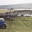
View of entrance to subterranean structure at Mine Howe.
View in Canmore
View in Canmore

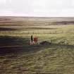
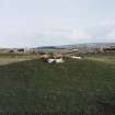
Mine Howe from the E.
View in Canmore
View in Canmore

View down lower flight of steps to cistern, after installation of handrail.
View in Canmore
View in Canmore


You may copy, display, store and make derivative works for personal use or use solely within an educational institution by staff and students, under these conditions: the ScotlandsPlaces website is attributed, there is no commercial use or sale, and no public distribution (for example, by hand, email, or web). Full licence details.
Details
Organisation: Historic Environment Scotland (HES)
Alternative name(s): Toab Parish Hall; Toab Cemetery; Minehowe
Canmore ID: 2998
Site type: Enclosure (iron Age), Grave(s) (late Iron Age), Inhumation(s) (late Iron Age), Metal Working Site (iron Age), Settlement (iron Age), Subterranean Structure (iron Age), Ring(s) (copper Alloy)(late Iron Age)
County: Orkney
Parish: St Andrews And Deerness
Council: Orkney Islands