Ettleton


Details
Organisation: Historic Environment Scotland (HES)
Alternative name(s):
Canmore ID: 162927
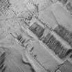
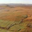
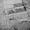
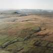
Site type: Settlement (later Prehistoric)
County: Roxburghshire
Parish: Castleton
Council: Scottish Borders, The

Organisation: Historic Environment Scotland (HES)
Alternative name(s):
Canmore ID: 162927
Site type: Settlement (later Prehistoric)
County: Roxburghshire
Parish: Castleton
Council: Scottish Borders, The