
Balbirnie


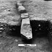
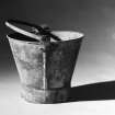
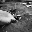
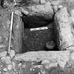
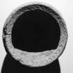
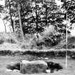
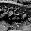
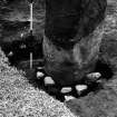
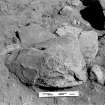
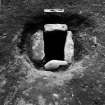
Excavation photograph showing cist with food vessel and knife.
View in Canmore
View in Canmore

SDD A2602-2
View in Canmore
View in Canmore

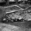
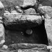
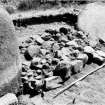
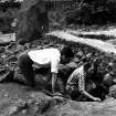
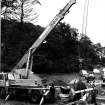
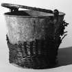
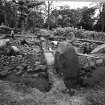
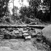
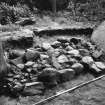
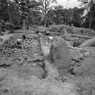
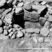
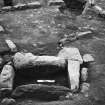
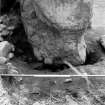
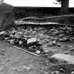
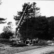
Excavation photographs
View in Canmore
View in Canmore

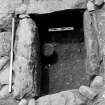
Excavation photographs
View in Canmore
View in Canmore

RCAHMS
View in Canmore
View in Canmore


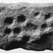
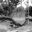
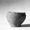
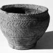
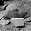
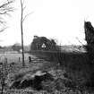
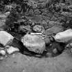
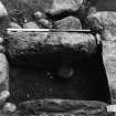
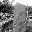
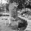
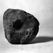
Cup-marked stone and food vessel
View in Canmore
View in Canmore


RCAHMS
View in Canmore
View in Canmore


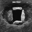
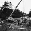
Excavation photographs
View in Canmore
View in Canmore

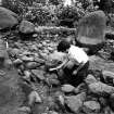
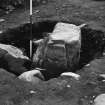
Excavation photographs
View in Canmore
View in Canmore

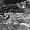
Excavation photographs
View in Canmore
View in Canmore

Excavation photographs
View in Canmore
View in Canmore

Excavation photographs
View in Canmore
View in Canmore

Excavation photographs
View in Canmore
View in Canmore

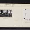
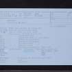
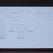
Balbirnie, NO20SE 4, Ordnance Survey index card, Recto
View in Canmore
View in Canmore

Balbirnie, NO20SE 4, Ordnance Survey index card, Recto
View in Canmore
View in Canmore

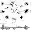
Plan of stone circle with a section drawing through site running SW-NE (lower levels). Also sections through cists 1-3.
View in Canmore
View in Canmore

RCAHMS
View in Canmore
View in Canmore


Excavation photographs
View in Canmore
View in Canmore

Excavation photographs
View in Canmore
View in Canmore

Balbirnie, NO20SE 4, Ordnance Survey index card, page number 1, Recto
View in Canmore
View in Canmore

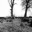
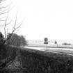
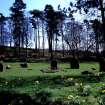
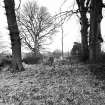
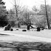
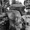
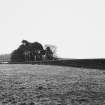
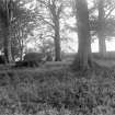
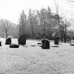
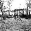
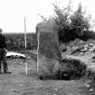
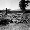
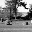
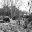
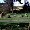
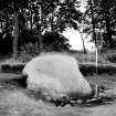
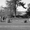
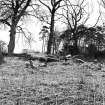
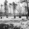
Stone circle and cairn, Balbirnie
View in Canmore
View in Canmore


RCAHMS
View in Canmore
View in Canmore


Excavation photograph showing cist with food vessel and knife.
View in Canmore
View in Canmore

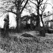
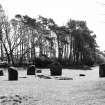
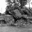
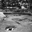
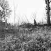
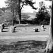
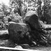
View of Balbirnie stone circle and cairn.
View in Canmore
View in Canmore


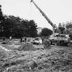
Excavation photographs
View in Canmore
View in Canmore

Excavation photographs
View in Canmore
View in Canmore

Excavation photographs
View in Canmore
View in Canmore

Balbirnie, NO20SE 4, Ordnance Survey index card, page number 1, Recto
View in Canmore
View in Canmore

Balbirnie, NO20SE 4, Ordnance Survey index card, page number 3, Recto
View in Canmore
View in Canmore

Balbirnie, NO20SE 4, Ordnance Survey index card, page number 4, Verso
View in Canmore
View in Canmore

RCAHMS
View in Canmore
View in Canmore

Excavation photographs
View in Canmore
View in Canmore


Excavation photographs
View in Canmore
View in Canmore

Balbirnie, NO20SE 4, Ordnance Survey index card, page number 2, Recto
View in Canmore
View in Canmore

View of Balbirnie stone circle and cairn.
View in Canmore
View in Canmore

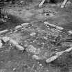
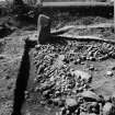
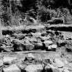
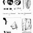
Plans of excavation and finds
View in Canmore
View in Canmore


RCAHMS
View in Canmore
View in Canmore

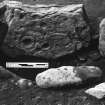
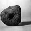
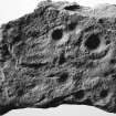
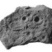
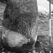
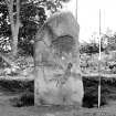
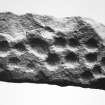
Cup-marked stone
View in Canmore
View in Canmore

Excavation photographs
View in Canmore
View in Canmore

Balbirnie, NO20SE 4, Ordnance Survey index card, page number 2, Verso
View in Canmore
View in Canmore

Balbirnie, NO20SE 4, Ordnance Survey index card, Recto
View in Canmore
View in Canmore
You may copy, display, store and make derivative works for personal use or use solely within an educational institution by staff and students, under these conditions: the ScotlandsPlaces website is attributed, there is no commercial use or sale, and no public distribution (for example, by hand, email, or web). Full licence details.